
|
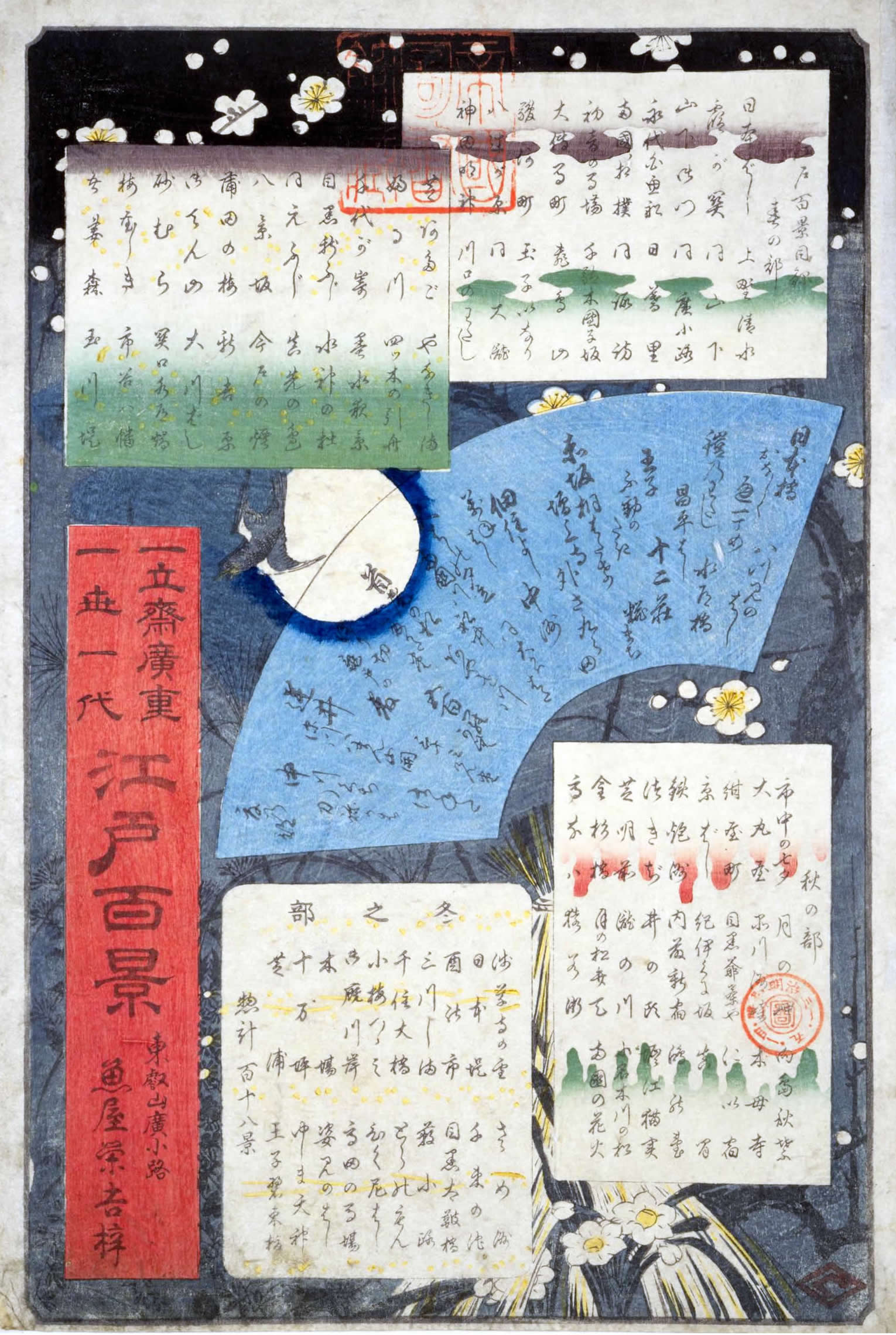
《名所江戸百景・秋の部》
市中繁栄七夕祭 大伝馬町こふく店 神田紺屋町 京橋竹がし 鉄炮洲稲荷橋湊神社 鉄炮洲築地門跡 芝神明増上寺 金杉橋芝浦 高輪うしまち 月の岬 品川すさき 目黒爺々が茶屋 紀の国坂赤坂溜池遠景 四ツ谷内藤新宿 井の頭の池弁天の社 王子滝の川 上野山内月のまつ 猿わか町よるの景 請地秋葉の境内 木母寺内川御前栽畑 にい宿のわたし 真間の紅葉手古那の社継はし 鴻の台とね川風景 堀江ねこざね 小奈木川五本まつ 両国花火
市中繁栄七夕祭 大伝馬町こふく店 神田紺屋町 京橋竹がし 鉄炮洲稲荷橋湊神社 鉄炮洲築地門跡 芝神明増上寺 金杉橋芝浦 高輪うしまち 月の岬 品川すさき 目黒爺々が茶屋 紀の国坂赤坂溜池遠景 四ツ谷内藤新宿 井の頭の池弁天の社 王子滝の川 上野山内月のまつ 猿わか町よるの景 請地秋葉の境内 木母寺内川御前栽畑 にい宿のわたし 真間の紅葉手古那の社継はし 鴻の台とね川風景 堀江ねこざね 小奈木川五本まつ 両国花火


地図について(出典など)
- 当サイトでは、国土地理院が提供する「地理院タイル」や、「OpenStreetMap」などを使用しています。ご利用に当たっては「地理院コンテンツ利用規約」「OpenStreetMap」などをご覧ください。それぞれの地図は、表示される縮尺が限られるもの、地域が限定されるものなどがあります。ここでは、地図の利用に当たって出典の明示が義務づけられているものの内、地図上に表示されるもの以外の出典、および凡例などを示します。このお知らせは、地理院タイルを利用する全てのページにおける共通のものであり、現在のページにおいて下記の地図の全てが表示されるとは限りません。
- ズームレベル 5~8:「The bathymetric contours are derived from those contained within the GEBCO Digital Atlas, published by the BODC on behalf of IOC and IHO (2003) (http://www.gebco.net)
海上保安庁許可第292502号(水路業務法第25条に基づく類似刊行物)」 - Shoreline data is derived from: United States. National Imagery and Mapping Agency. "Vector Map Level 0 (VMAP0)." Bethesda, MD: Denver, CO: The Agency; USGS Information Services, 1997.
- ズームレベル 5~8:Shoreline data is derived from: United States. National Imagery and Mapping Agency. "Vector Map Level 0 (VMAP0)." Bethesda, MD: Denver, CO: The Agency; USGS Information Services, 1997.
- ズームレベル 2~8:Shoreline data is derived from: United States. National Imagery and Mapping Agency. "Vector Map Level 0 (VMAP0)." Bethesda, MD: Denver, CO: The Agency; USGS Information Services, 1997.
- ズームレベル 5~8:「The bathymetric contours are derived from those contained within the GEBCO Digital Atlas, published by the BODC on behalf of IOC and IHO (2003) (http://www.gebco.net)
海上保安庁許可第292502号(水路業務法第25条に基づく類似刊行物)」
Shoreline data is derived from: United States. National Imagery and Mapping Agency. "Vector Map Level 0 (VMAP0)." Bethesda, MD: Denver, CO: The Agency; USGS Information Services, 1997. - Geospatil Information Authority of Japan (GSI)
《地理院写真》- ズームレベル 9~13:Landsat8画像(GSI,TSIC,GEO Grid/AIST), Landsat8画像(courtesy of the U.S. Geological Survey), 海底地形(GEBCO)
- ズームレベル 2~8:Images on 世界衛星モザイク画像 obtained from site https://lpdaac.usgs.gov/data_access maintained by the NASA Land Processes Distributed Active Archive Center (LP DAAC), USGS/Earth Resources Observation and Science (EROS) Center, Sioux Falls, South Dakota, (Year). Source of image data product.
《地理院色別標高図》ズームレベル 5~15- 海域部は海上保安庁海洋情報部の資料を使用して作成.
- ズームレベル 5~8:「The bathymetric contours are derived from those contained within the GEBCO Digital Atlas, published by the BODC on behalf of IOC and IHO (2003) (http://www.gebco.net)
スポンサーリンク
スポンサーリンク
おすすめサイト・関連サイト…
スポンサーリンク