
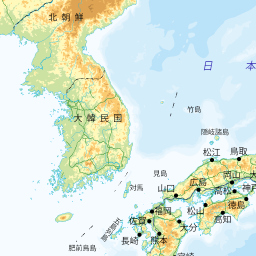
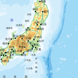
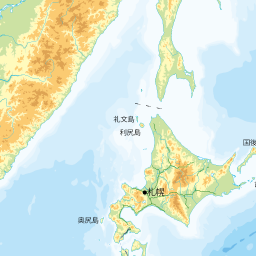
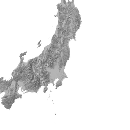
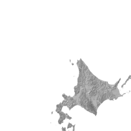
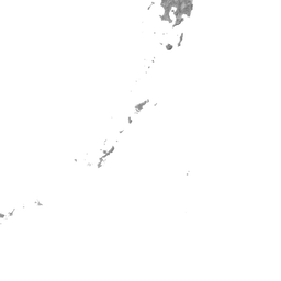
地図で見る
|
- データは、国土地理院の「都道府県の最高地点」によります。詳細は「国土地理院 」でご確認ください。
- このページでの地図の初期設定は、地理院地図に陰影起伏図を重ねています。
| 都道府県 | 山名〈山頂名〉 | 所在等 | 標高 |
|---|---|---|---|
| 北海道 | 石狩山地 | 2291m | |
| 青森県 | 白神山地 | 1625m | |
| 岩手県 | 奥羽山脈北部 | 2038m | |
| 宮城県 | 奥羽山脈南部(蔵王山とその周辺) | 1825m | |
| 秋田県 | 出羽山地 | 1757m | |
| 山形県 | 出羽山地 | 2236m | |
| 福島県 | 南会津・尾瀬 | 2356m | |
| 茨城県 | 八溝山・筑波山 | 1022m | |
| 栃木県 | 那須・日光 | 2578m | |
| 群馬県 | 那須・日光 | 2578m | |
| 埼玉県 | 関東山地 | 2483m | |
| 千葉県 | 房総・三浦 | 408m | |
| 東京都 | 関東山地 | 2017m | |
| 神奈川県 | 丹沢山地 | 1673m | |
| 新潟県 | 飛驒山脈北部 | 2766m | |
| 富山県 | 飛驒山脈北部 | 3015m | |
| 石川県 | 白山山地 | 2702m | |
| 福井県 | 白山山地 | 2095m | |
| 山梨県 | 富士山とその周辺 | 3776m | |
| 長野県 | 飛驒山脈南部 | 3190m | |
| 岐阜県 | 飛驒山脈南部 | 3190m | |
| 静岡県 | 富士山とその周辺 | 3776m | |
| 愛知県 | 美濃・三河高原 | 1416m | |
| 三重県 | 紀伊山地東部(大台原山とその周辺) | 1695m | |
| 滋賀県 | 越美・伊吹山地 | 1377m | |
| 京都府 | 琵琶湖周辺 | 971m | |
| 大阪府 | 生駒・金剛・和泉山地 | 1056m | |
| 兵庫県 | 中国山地東部 | 1510m | |
| 奈良県 | 紀伊山地東部(大峰山脈) | 1915m | |
| 和歌山県 | 紀伊山地西部 | 1382m | |
| 鳥取県 | 中国山地中部 | 1729m | |
| 島根県 | 中国山地西部 | 1346m | |
| 岡山県 | 中国山地東部 | 1344m | |
| 広島県 | 中国山地西部 | 1346m | |
| 山口県 | 中国山地西部 | 1337m | |
| 徳島県 | 四国山地東部(剣山地) | 1955m | |
| 香川県 | 讃岐山地とその周辺 | 1060m | |
| 愛媛県 | 四国山地西部(石鎚山地) | 1982m | |
| 高知県 | 四国山地東部(剣山地) | 1894m | |
| 福岡県 | 阿蘇・くじゅうとその周辺 | 1230m | |
| 佐賀県 | 佐賀西部・長崎・島原 | 1076m | |
| 長崎県 | 佐賀西部・長崎・島原 | 1483m | |
| 熊本県 | 九州山地 | 1739m | |
| 大分県 | 阿蘇・くじゅうとその周辺 | 1791m | |
| 宮崎県 | 九州山地 | 1756m | |
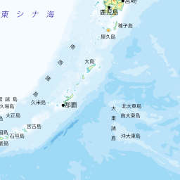
| 鹿児島県 | 大隅諸島(屋久島) | 1936m | |
| 沖縄県 | 八重山列島(石垣島) | 526m |
《都道府県の最高地点》


地図について(出典など)
- 当サイトでは、国土地理院が提供する「地理院タイル」や、「OpenStreetMap」などを使用しています。ご利用に当たっては「地理院コンテンツ利用規約」「OpenStreetMap」などをご覧ください。それぞれの地図は、表示される縮尺が限られるもの、地域が限定されるものなどがあります。ここでは、地図の利用に当たって出典の明示が義務づけられているものの内、地図上に表示されるもの以外の出典、および凡例などを示します。このお知らせは、地理院タイルを利用する全てのページにおける共通のものであり、現在のページにおいて下記の地図の全てが表示されるとは限りません。
- ズームレベル 5~8:「The bathymetric contours are derived from those contained within the GEBCO Digital Atlas, published by the BODC on behalf of IOC and IHO (2003) (http://www.gebco.net)
海上保安庁許可第292502号(水路業務法第25条に基づく類似刊行物)」 - Shoreline data is derived from: United States. National Imagery and Mapping Agency. "Vector Map Level 0 (VMAP0)." Bethesda, MD: Denver, CO: The Agency; USGS Information Services, 1997.
- ズームレベル 5~8:Shoreline data is derived from: United States. National Imagery and Mapping Agency. "Vector Map Level 0 (VMAP0)." Bethesda, MD: Denver, CO: The Agency; USGS Information Services, 1997.
- ズームレベル 2~8:Shoreline data is derived from: United States. National Imagery and Mapping Agency. "Vector Map Level 0 (VMAP0)." Bethesda, MD: Denver, CO: The Agency; USGS Information Services, 1997.
- ズームレベル 5~8:「The bathymetric contours are derived from those contained within the GEBCO Digital Atlas, published by the BODC on behalf of IOC and IHO (2003) (http://www.gebco.net)
海上保安庁許可第292502号(水路業務法第25条に基づく類似刊行物)」
Shoreline data is derived from: United States. National Imagery and Mapping Agency. "Vector Map Level 0 (VMAP0)." Bethesda, MD: Denver, CO: The Agency; USGS Information Services, 1997. - Geospatil Information Authority of Japan (GSI)
《地理院写真》- ズームレベル 9~13:Landsat8画像(GSI,TSIC,GEO Grid/AIST), Landsat8画像(courtesy of the U.S. Geological Survey), 海底地形(GEBCO)
- ズームレベル 2~8:Images on 世界衛星モザイク画像 obtained from site https://lpdaac.usgs.gov/data_access maintained by the NASA Land Processes Distributed Active Archive Center (LP DAAC), USGS/Earth Resources Observation and Science (EROS) Center, Sioux Falls, South Dakota, (Year). Source of image data product.
《地理院色別標高図》ズームレベル 5~15- 海域部は海上保安庁海洋情報部の資料を使用して作成.
- ズームレベル 5~8:「The bathymetric contours are derived from those contained within the GEBCO Digital Atlas, published by the BODC on behalf of IOC and IHO (2003) (http://www.gebco.net)
スポンサーリンク
スポンサーリンク
おすすめサイト・関連サイト…
スポンサーリンク